

BOUNDARY / VECTOR IMPORT
Flexible spatial selection
Use administrative areas, draw an extent or import GeoJSON, Shapefile, KML / KMZ.
GeoJSON · SHP · KMLFrom area selection to delivery, work with imagery, DEM, 3D Tiles and historical data in one workspace. Process everything on desktop, or connect through a browser, CLI or Agent as needed.
View source on GitHub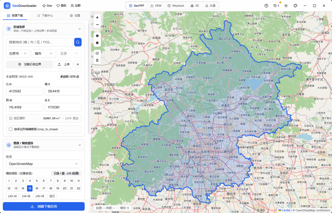
From imagery and DEM to vector and 3D data, organize downloads and processing by conversation. Files, PostGIS and drawn areas can all feed into your tasks.
Windows beta 0.2.3 available · Local 0.2.4 candidate in preparation
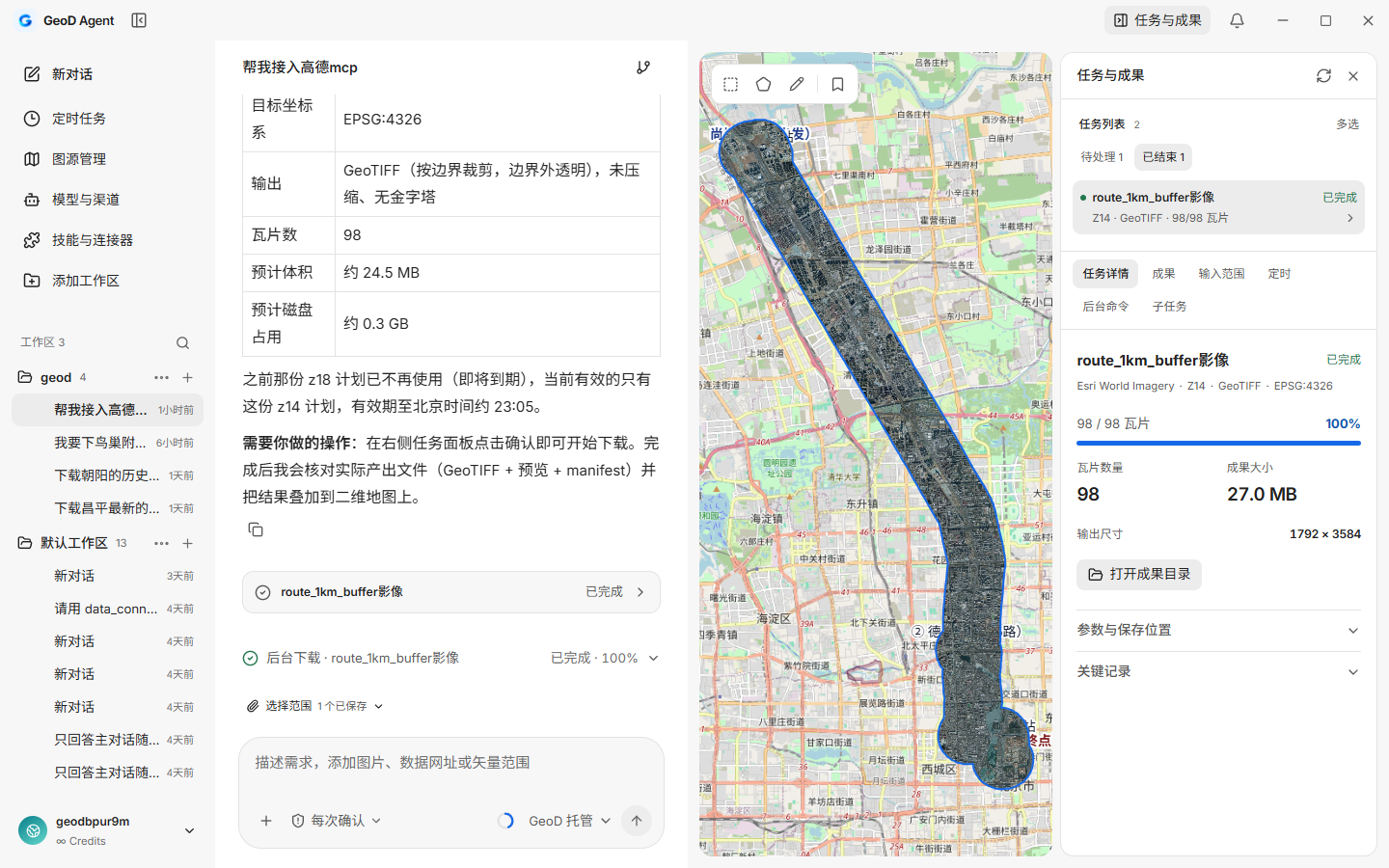
GeoD brings scattered data acquisition steps into one desktop workspace. Download tasks, spatial boundaries and exported outputs stay connected across your workflow.
Download GeoD to get startedGeoD offers configuration for common services and accepts XYZ / WMTS URL templates. Confirm the provider's authorization scope, access quotas and offline-use policy before use.
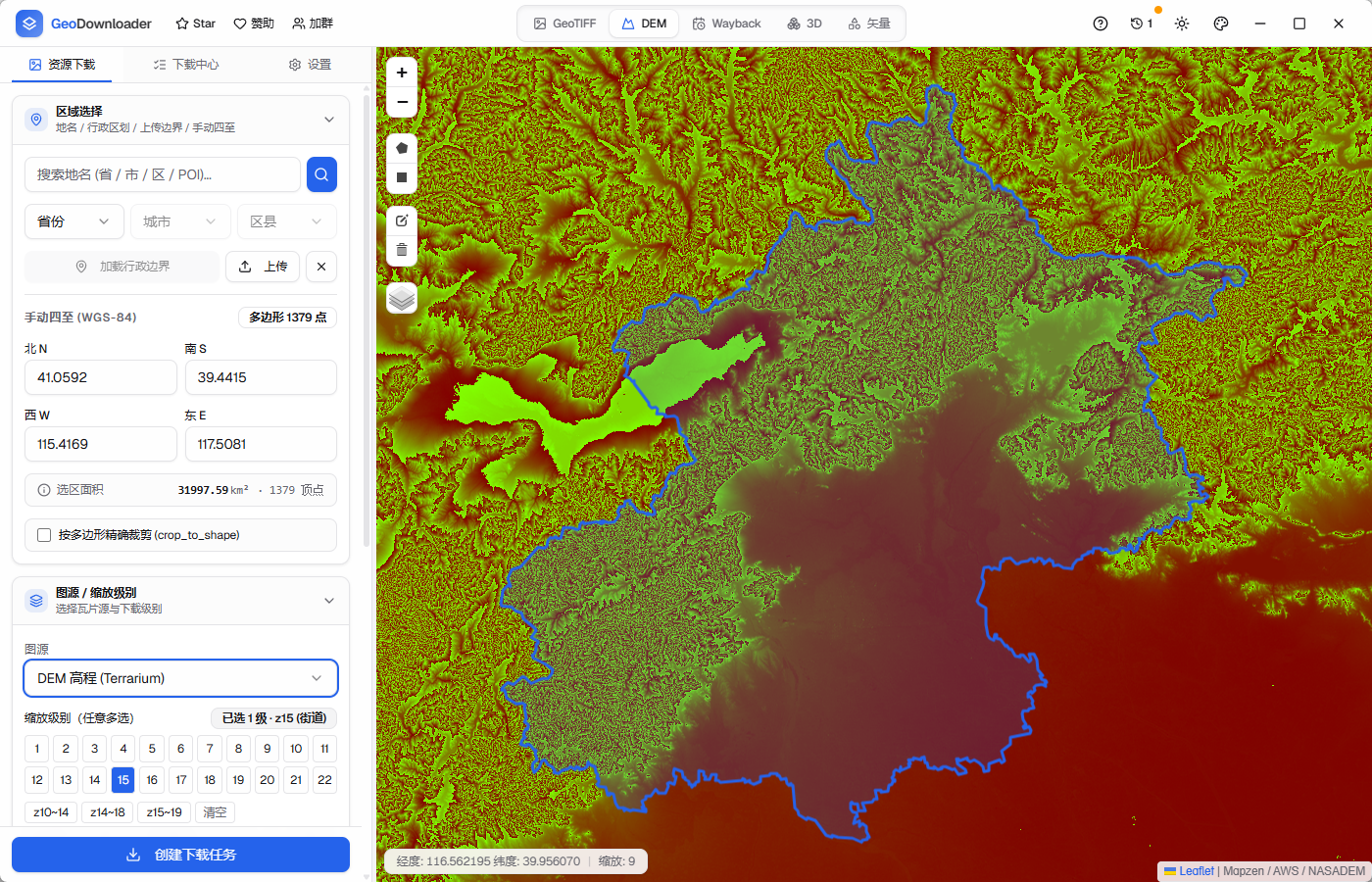
Source management · XYZ / WMTS URL templatesDownload Terrain Tiles elevation data by administrative area, drawn extent or imported vector boundary. Spatially filter Cesium Ion and authorized 3D Tiles services to create tasks.
DEM · 3D Tiles · LOD filtering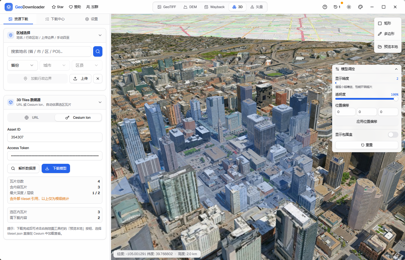
Browse imagery versions from different dates with Esri World Imagery Wayback, compare regional changes and add the selected version to a download task.
Esri Wayback · Timeline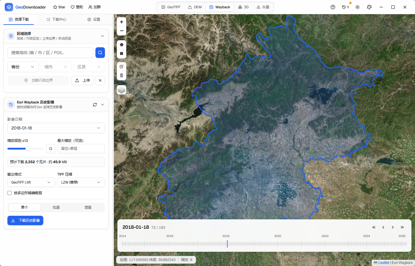
Use administrative areas, draw an extent or import GeoJSON, Shapefile, KML / KMZ.
GeoJSON · SHP · KMLParallel tasks, resumable downloads and retries make long tasks more stable and manageable.
Parallel · Resume · RetryWrite coordinate and projection tags automatically, with LZW / Deflate compression and BigTIFF for large areas.
LZW · DEFLATE · BIGTIFFRuns natively on Windows, macOS and Linux. Move cache directories to suit your work environment.
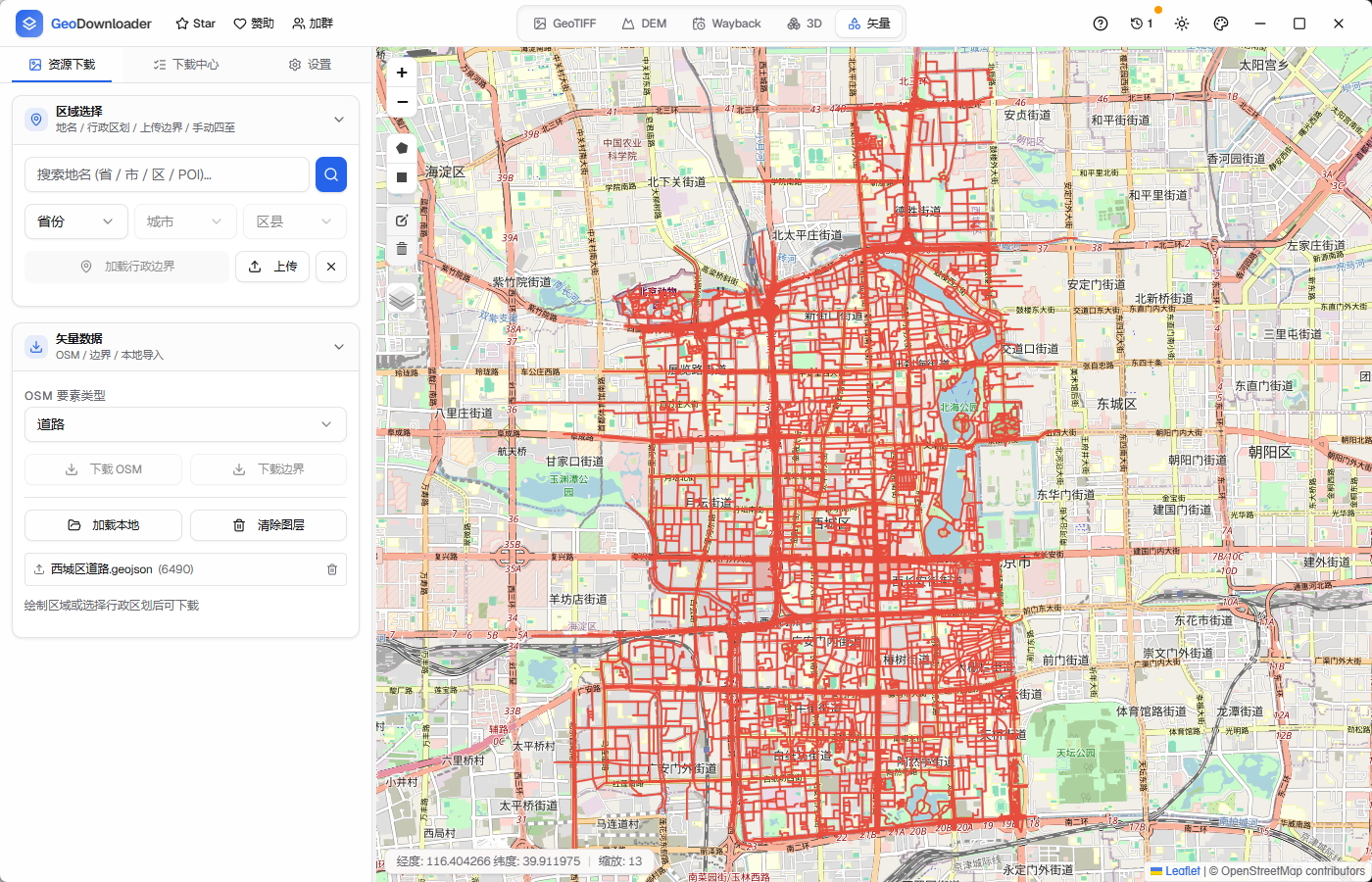
Windows · macOS · LinuxMap interaction, configuration, task progress and previews follow the same desktop workflow. Switch modules to explore actual GeoD interfaces for different data types.
GeoD CLI plans and downloads with command arguments; GeoD MCP lets Agents call planning, task and output tools. Both work with actual download results.
GeoD is free and open source, supporting Windows, macOS and Linux. The current stable version is v3.6.10. Choose your platform to download an installer.
If GitHub downloads are slow, use the China download mirror. See all versions and release notes in the GitHub Releases.
Find documentation, releases, discussions and usage boundaries to get started and keep up with the project.
Follow the WeChat account for releases, tutorials and common questions. Join the technical group to discuss GIS data downloads, processing and delivery.
 WeChat official accountReleases, tutorials and common questions
 Technical groupDiscuss GIS data downloads, processing and delivery
Start with one area and bring the data into your workflow.
Download GeoD now