

CLARIFY YOUR REQUIREMENTS
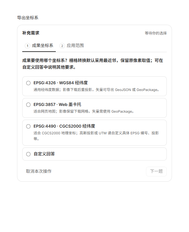
Choose your coordinates and historical period first.
Unclear parameters appear as choice cards. Reopen them later from the conversation. Changing only the zoom level preserves the confirmed coordinate system.
Imagery, DEM, historical imagery, vectors and 3D data start with a conversation.
Review the plan, then download, process and verify outputs on your own computer.
Available now: beta 0.2.3 · Windows x64Explore the 0.2.4 changes
 View full screenshot
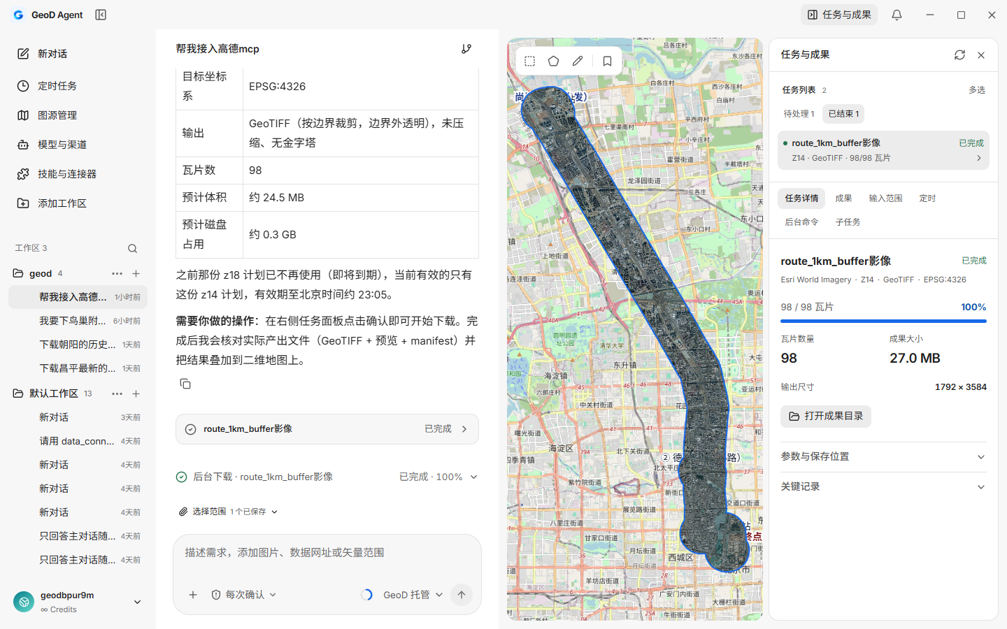
Manage workspaces and conversations on the left, organize tasks in the center, view areas on the map, and review plans, progress and outputs on the right.
 View full screenshot
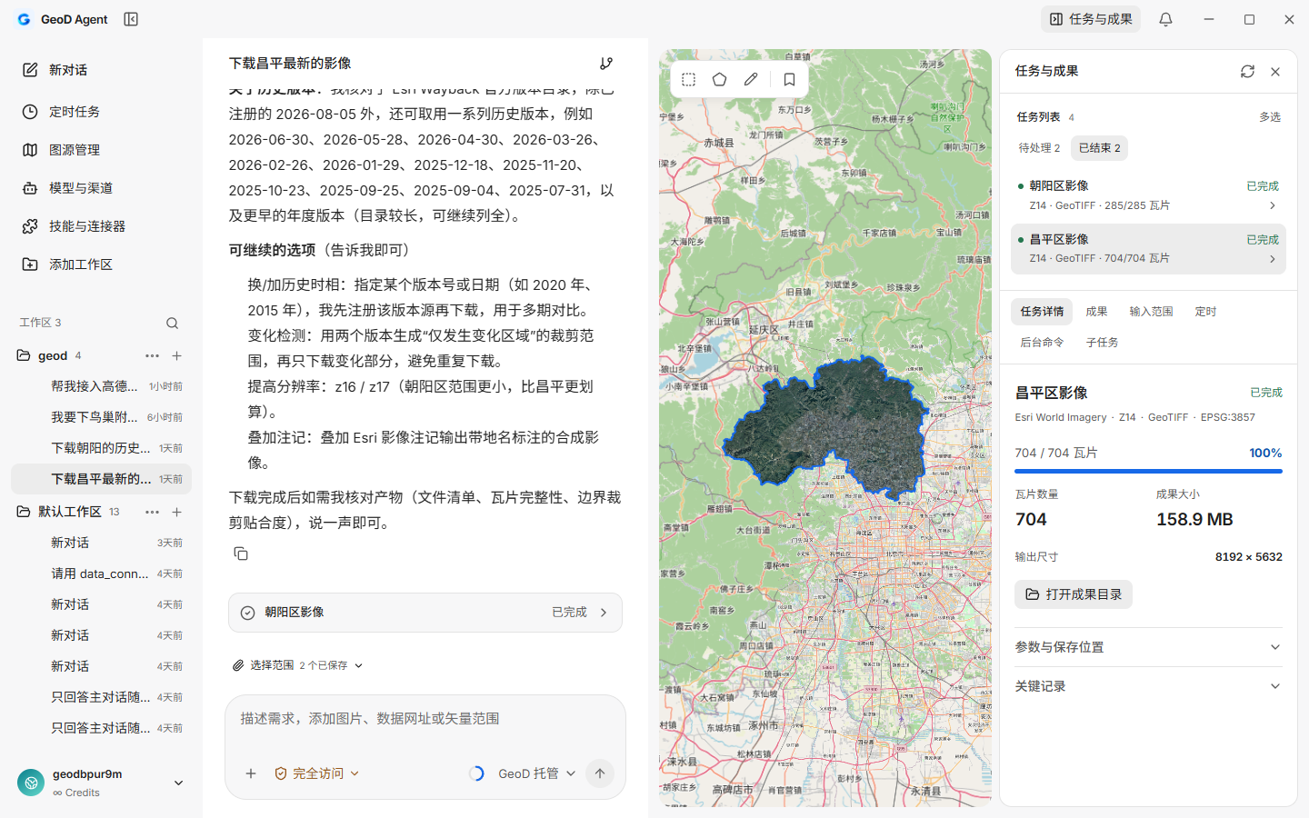
Changping imagery was cropped to the administrative boundary and loaded onto the map. The output panel records actual file sizes and distinguishes tile progress from final delivery.
 View full screenshot
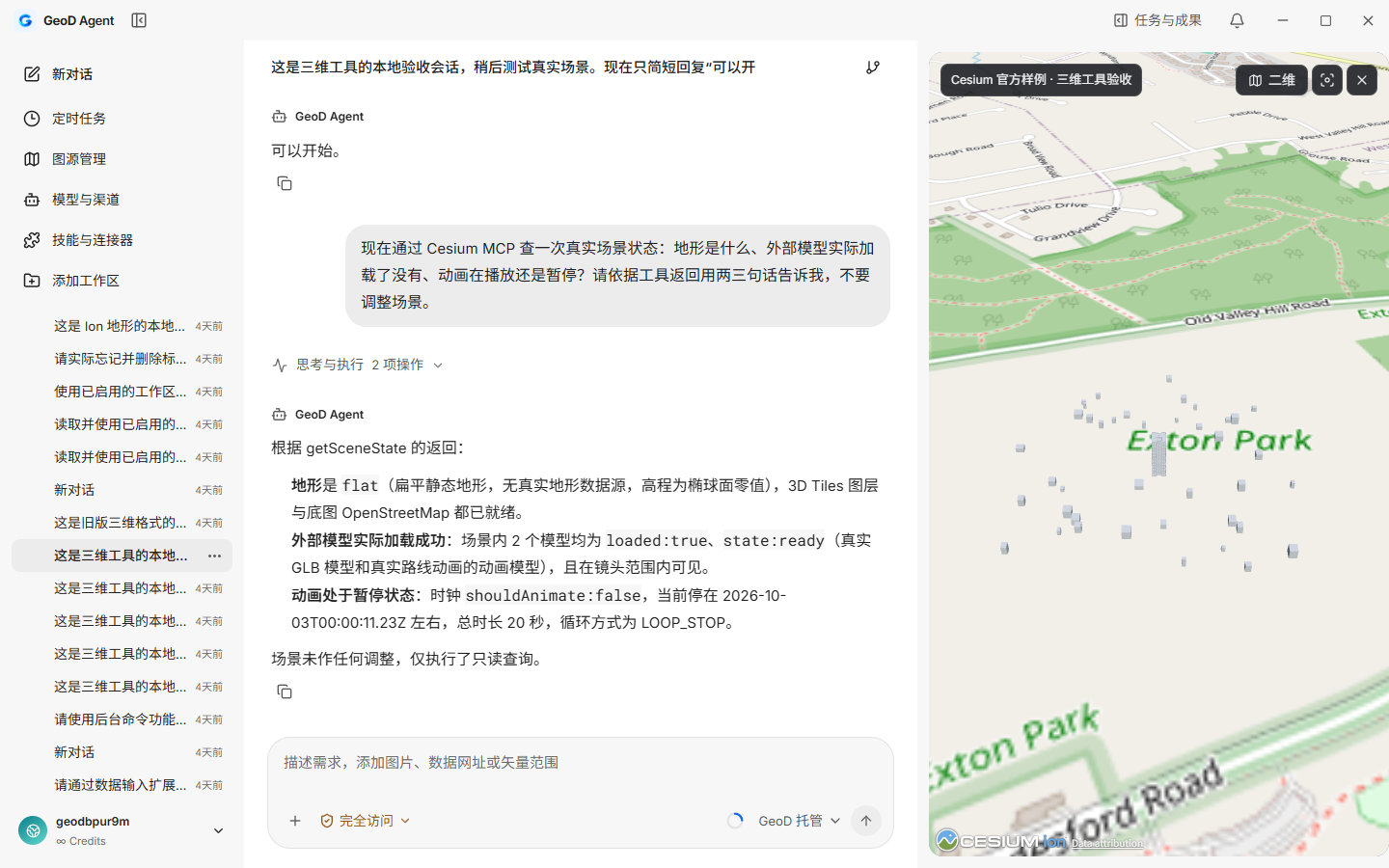
Open downloaded local 3D Tiles in the same workspace, switch between 2D and 3D, adjust the camera, manage layers and locate outputs.
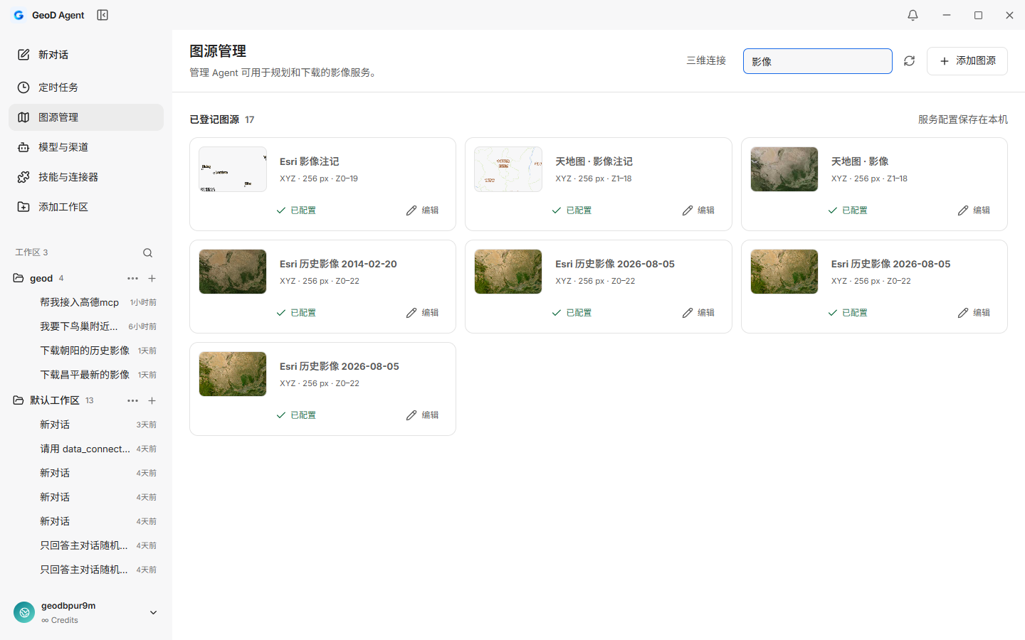 View full screenshot
View source thumbnails, levels and configuration; manage your own service connections. Enter required keys or tokens locally.
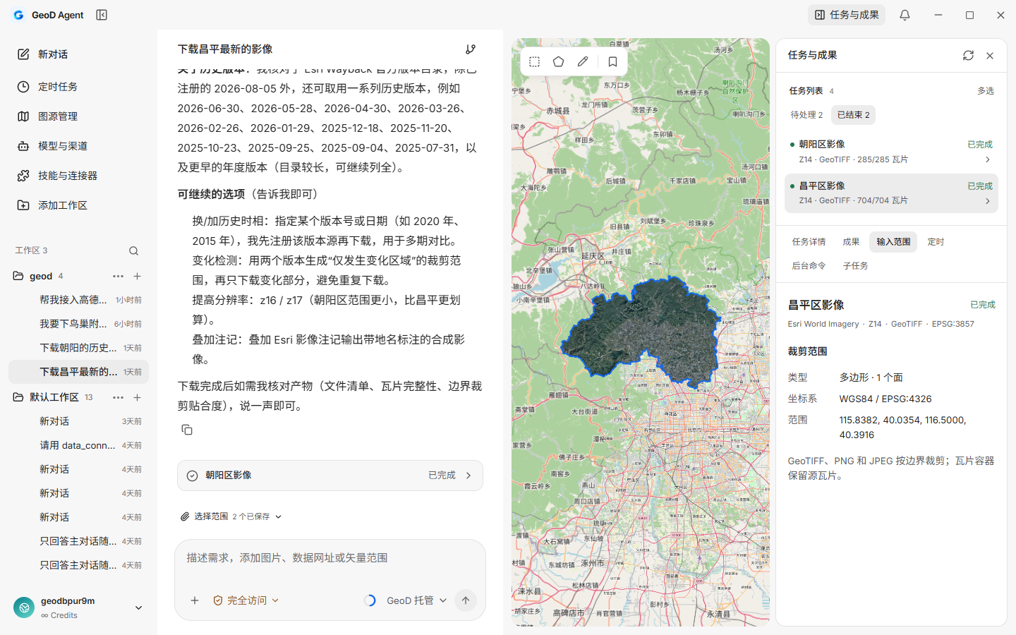 View full screenshot
Draw rectangles or polygons, drag vertices, name areas and save bookmarks. Saved areas can become inputs for later tasks.
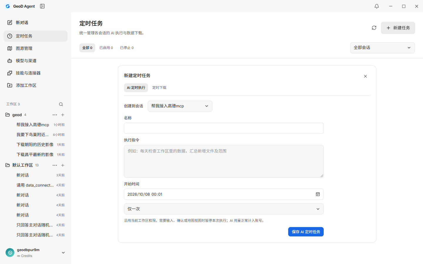 View full screenshot
Create scheduled AI runs or downloads on a dedicated page, view records, pause future triggers or cancel a run. Tasks can continue while the local background process is running.
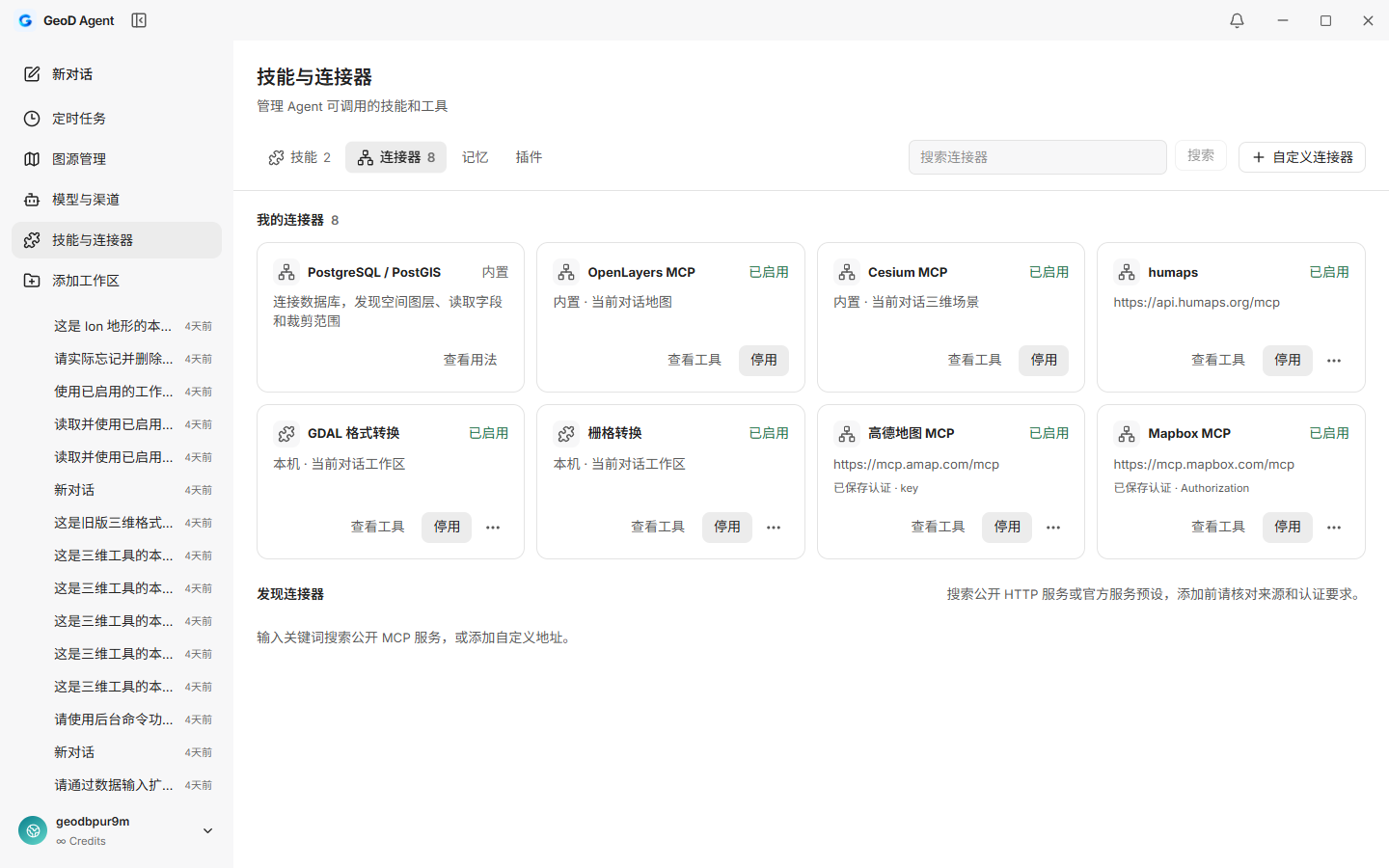 View full screenshot
Manage Skills and MCP; connect PostgreSQL / PostGIS, GDAL and map tools so the Agent can work from actual results.
Work around a data task with plans and progress always available.
AI organizes the task; you review sources, areas and outputs. Task states and output files record the execution.
Specify the area, data type and purpose, or attach an existing boundary file.
Check the source, area, resolution, format and save location, then approve execution.
Downloads, stitching and clipping run locally, with progress and task status available at any time.
View results on the map, read output files and integrity manifests, then continue your workflow.
This release refines the download workflow: clarify missing parameters, retain confirmed choices and offer required skills. It has not been published yet.
Unclear parameters appear as choice cards. Reopen them later from the conversation. Changing only the zoom level preserves the confirmed coordinate system.
Five GIS skills install independently and share downloaded dependencies. Java and local OCR are removed from the base installer; add processing tools as needed.
These are actual component verification screenshots; choices and installation states illustrate the interaction. The 0.2.4 installer and clean Windows acceptance are still pending.
Plan, download and inspect different data types in one conversation workspace. This includes local 0.2.4 candidate capabilities. See the release notes for the public 0.2.3 installer.
Choose a source, stitch and clip, then take usable imagery into your workflow.
All six outputs verified in development, with independent file readback
Decode elevation tiles into actual elevation data in meters.
Real model-driven tasks and elevation files verified through readback
Revisit the same area across versions for comparison and archiving.
Actual historical tiles and outputs verified; update comparisons use metadata
Retrieve features or keep source tiles, choosing the right output for your next step.
Intersecting features keep full geometry; PBF / MBTiles keep complete selected tiles
Download authorized 3D data and view it in your workspace.
Official samples and Ion buildings verified; spatial filtering keeps whole models
Access, resolution and download permission depend on the data provider. A successful source connection does not grant download rights.
Files, databases, online features and hand-drawn areas can all start a task. Thirteen input methods have been verified locally through reading, planning, download clipping and output checks.
Drag a rectangle or draw a polygon point by point. Edit vertices, name and bookmark the area, then use it in the current conversation.
Attach a project boundary to the conversation and read or transform its coordinates. Multiple polygons and holes are preserved, without manually copying coordinates.
Discover spatial layers, read attributes and extents, then use queried areas for downloads. Database passwords are managed by local credentials.
Provide an online vector file or feature endpoint, then connect its area to the task plan.
Manage presets and custom services together, with labels, subdomain rotation and coordinate handling for supported sources. Authenticate with query parameters, Bearer Tokens or custom headers. Keys and tokens stay in the local credential store; the model reads configuration summaries.
Online inputs support feature responses. Automatic service discovery, full pagination and additional database types are still in progress.
The Agent organizes plans; your computer handles downloads and monitoring. Keep talking, or return to the task panel to check actual status.
Keep multiple input areas, download selected areas together or split them into separate tasks. Each has its own plan, save location and outputs.
View tasks awaiting approval, running or completed. Inspect details, process tasks in batches, load outputs on the map or open local files.
Imagery tasks retain verified tiles and resume after a pause or app restart. Interrupted vector and 3D tasks can be checked again and retried.
Create a new recovery plan for imagery and reuse valid cache. Export only cached coverage when needed, with missing areas clearly marked.
Run imagery downloads once or on a recurring schedule; save scheduled templates for vector / 3D tasks too. Keep run history, with separate controls for future triggers and the current run.
Check disk usage and integrity, organize older cache and move storage. Reuse is tied to source versions; available space is checked before migration.
Scheduled tasks require the local companion to remain running. Closing the window allows work to continue; explicitly stopping the companion stops execution. Permissions determine automatic execution, and missed cycles are combined on reconnection.
From built-in maps to local processing and selected extensions. The Agent continues from actual tool results; new connectors require your approval before activation.
Built-in OpenLayers tools adjust the view, manage layers, add GeoJSON and annotations, load imagery outputs and read map state.
Built-in Cesium tools adjust the camera, control buildings, add objects and change basemaps. Existing scenes are preserved when switching between 2D and 3D.
Install boundary import, vector conversion, vector analysis, raster inspection and raster conversion separately. When a task needs a skill, review the download prompt and continue after installation. File operations stay within the current workspace.
Search the skill catalog, paste a link or import a local package. GitHub and local Skills retain scripts, references and assets for review before enabling.
Discover HTTP MCP services, connect and list actual tools, then approve activation. Tool arguments, results and errors are visible in the conversation.
Use a GeoD hosted model or configure your own model service and compatible gateway. Inspect execution logs, steer or stop a turn, and keep conversations and task history in workspaces.
Skill scripts require local dependencies. In 0.2.4, GIS tools install separately and share dependencies. HTTP and stdio MCP, authentication headers and browser OAuth are implemented; each external service needs validation. Camera, object, layer, basemap and view switching have been checked; further scene tools are verified individually.
Outputs stay in your local workspace. View completed downloads on the map and check the file manifest for completeness.
Export rasters, vectors, tile archives and 3D resources. Version 0.2.4 defaults to uncompressed output, with optional compression and overviews. Reproject to a specified EPSG coordinate system for your GIS workflow.
Record sizes, hashes and resource references to check outputs. Missing coverage and partial exports are clearly marked rather than presented as complete delivery.
Load local imagery, vector and 3D outputs and navigate to the task area. Plans, sources and run records remain attached for later review.
These requests illustrate combinations of capabilities. Sources, areas, formats and permissions still need review before execution.
“Download imagery for these areas separately, then produce one merged and clipped result.”
Split or merge areas → Assign tasks → Separate outputsDatabase-driven tasks“Read project boundaries from PostGIS and use them to clip the imagery I need.”
Connect and discover layers → Read boundaries → Download and clipArchive historical data“Show historical imagery versions for this area and download the selected date.”
Find versions → Check dates → Historical outputsView 3D outputs“Load the 3D output, view the buildings obliquely from the south, then switch back to 2D.”
Load scene → Adjust camera → Switch views“Download the latest imagery for Changping.”
The local task downloaded 704 Changping tiles, clipped them to the administrative boundary and exported a GeoTIFF. Review coverage on the map and inspect the completion status, actual file size and output folder in the task panel.
Output downloaded on 2026-10-06 · Screenshot of the current light development build
Esri World Imagery · Z14 · EPSG:3857 · 8192 × 5632 pixels. File size and completion status in the screenshot come from the actual task.
The model service interprets requests and organizes tool calls. Tile downloads, stitching, clipping and file checks run locally; imagery tiles do not pass through the GeoD model server.
AI requests send task descriptions and necessary tool information to the model service. You still need appropriate data access and download rights; a connection does not grant a data license.
An independent desktop app with model channels, 2D and 3D maps, task management, online updates and a message center. Paid billing is not open yet.
Candidate improvements on this page have been checked locally. The public download will change after packaging, upgrade regression and clean Windows acceptance are complete.
Licensing, quotas, imagery dates and resolution depend on the source. 3D Tiles boundary selection preserves whole models rather than cutting model geometry.
Try the current beta and share feedback from your workflow. Follow our WeChat account or join the community for updates and guides.
Version 0.2.4 has not been published. Local candidate changes are labeled on this page. The beta does not imply validation of every source, workload or external service.

If a QR code expires, add WeChat contact gpb230314 and mention GeoD Agent.